Tunisian FerryBox project presentation
Project timeline, goals, scheme, database and devices description, and more
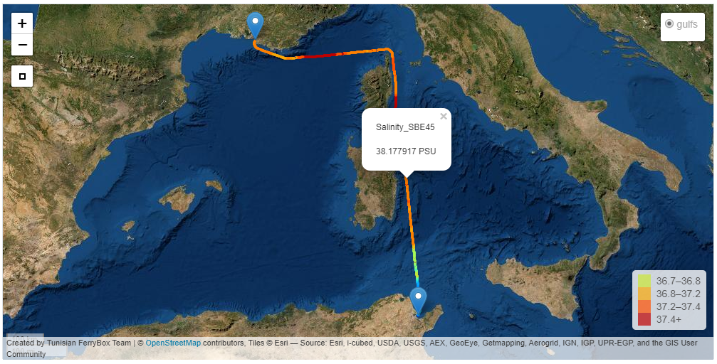
Visualize FerryBox Marine data
48 recieved files.
Test data seasonality
2.08 % Data repartition per month
Asses data quality
12.12% of truncated vs correct files
FerryBox
Applying innovative technologies in service of surface marine data collecting, storage, treatment and exploitation
FerryBox
Applying innovative technologies in service of surface marine data collecting, storage, treatment and exploitation
FerryBox
Applying innovative technologies in service of surface marine data collecting, storage, treatment and exploitation
FerryBox
Applying innovative technologies in service of surface marine data collecting, storage, treatment and exploitation
FerryBox
Applying innovative technologies in service of surface marine data collecting, storage, treatment and exploitation
FerryBox
Applying innovative technologies in service of surface marine data collecting, storage, treatment and exploitation
|
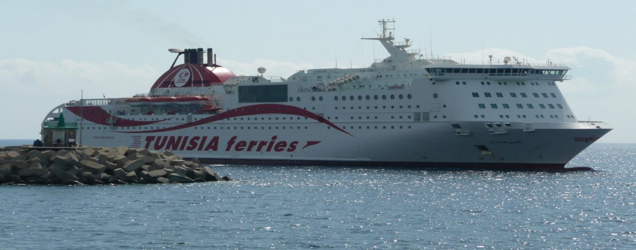
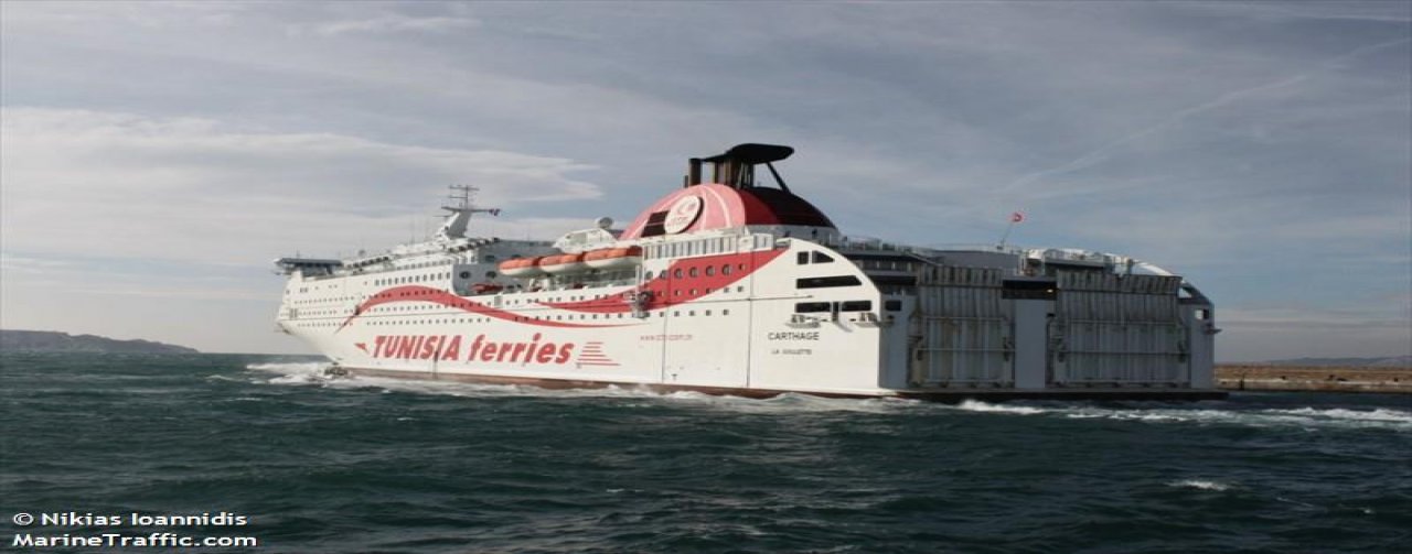
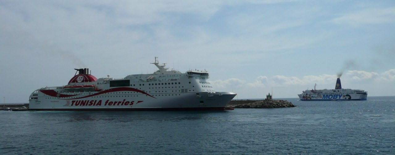
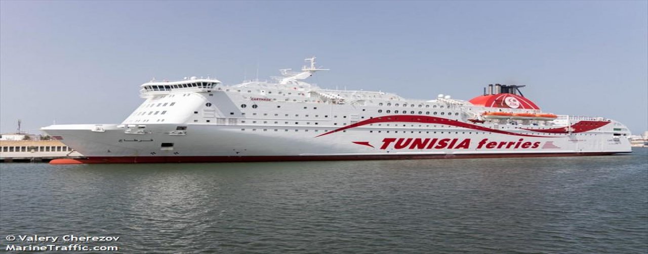
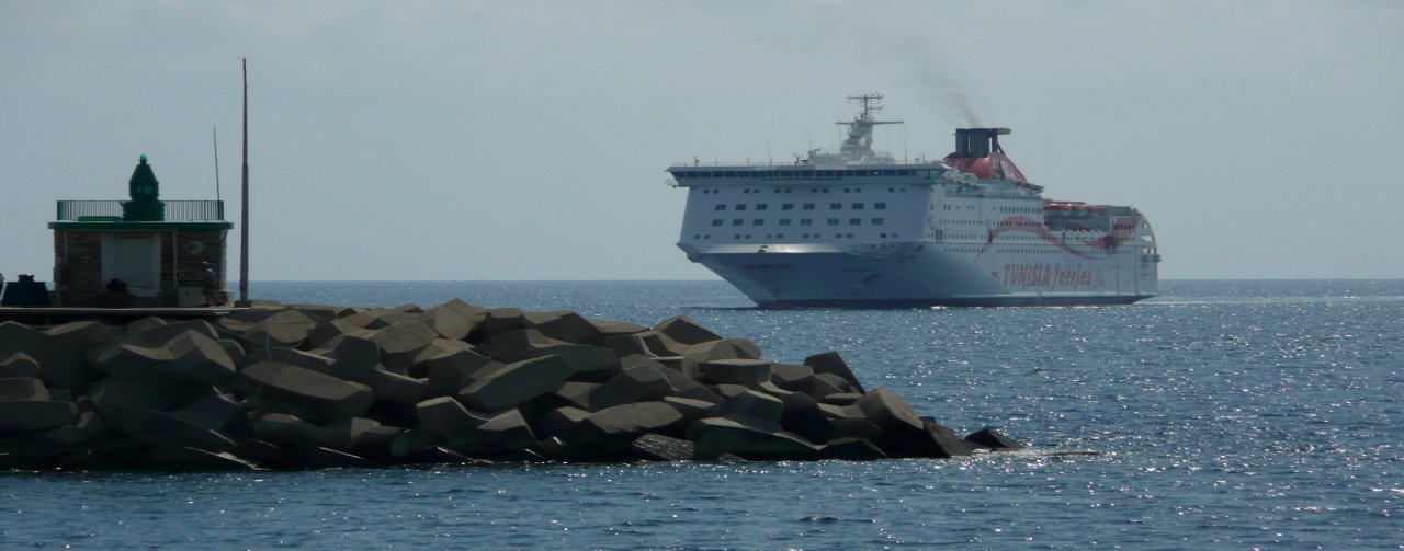
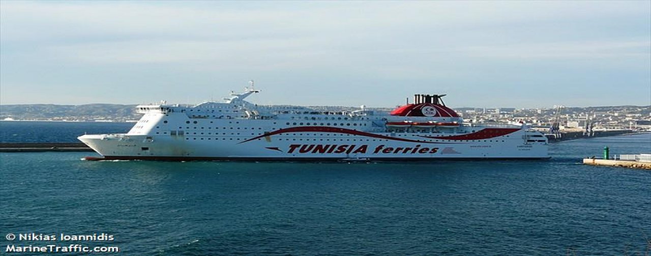
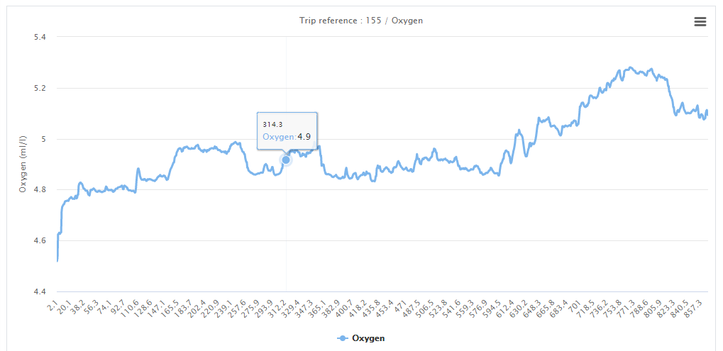
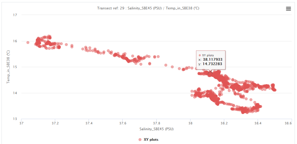
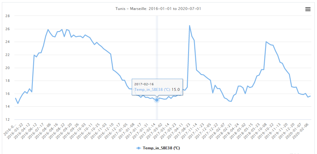
The Tunisian FerryBox project is an initiative that’s targeting water masse tracking and measuring. It is materialized by a set of sensors that are implemented in Carthage ferry, at 5 meters depth. It is measuring, for each minute of the ferry’s trip, several parameters (Temperature, Salinity, Dissolved oxygen, Turbidity, pH…) The first launch of FerryBox data collecting campaigns was on 2016. The growing database offers several interesting scientific possibilities: Currently, The Tunisian FerryBox is involved in the CLAIM EU 2020 project. The Tunisian FerryBox device is a measuring device tracking water masses properties and dynamics. The device is fixed at 5 meter depth, in Carthage ferry. It has a sampling frequency of 1 minute, and measures, for each sample : Below is the timeline of the FerryBox project main events and ameliorations: |
|
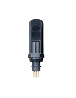
Seapoint Turbidity MeterThe Seapoint Turbidity Meter detects light scatterd by particles suspended in water, generating an output voltage proportional to turbidity or suspended solids. 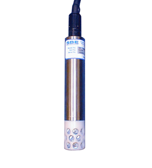
SBE38 Digital Oceanographic ThermometerThe SBE 38 is frequently integrated as a remote temperature sensor with an SBE 21 Thermosalinograph or SBE 45 MicroTSG, to provide accurate sea surface temperature. 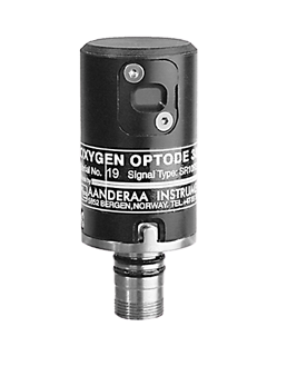
AADI Oxygen optodeThe Oxygen optode is designed to measure absolute oxygen concentration and % saturation. The optode can be used from streams to deep sea, from fish farms to waste water and from polar ice areas to hydrothermal vents. 
SBE45 MicroTSG ThermosalinographThe externally powered SBE 45, typically mounted near the ship’s seawater intake, accurately determines sea surface temperature and conductivity from underway vessels. Measured data and derived variables (salinity, sound velocity) are output in real-time in engineering units. 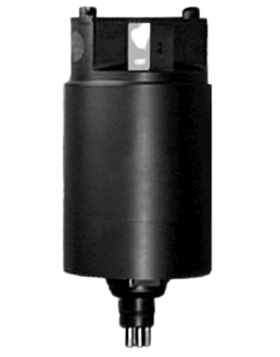
Seapoint Chlorophyll-aThe Seapoint Chlorophyll Fluorometer (SCF) is a high-performance, low power instrument for in situ measurements of chlorophyll. Its small size, very low power consumption, high sensitivity, wide dynamic range, 6000 meter depth capability, and open or pump-through sample volume options provide the power and flexibility to measure chlorophyll in a wide variety of conditions. |
|
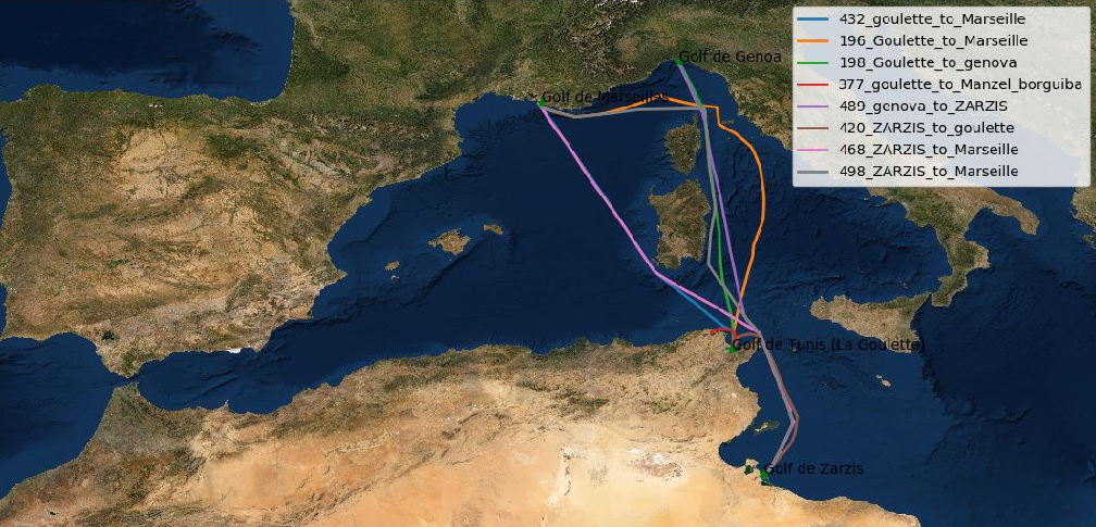
Total number of files Carthage is a Tunisian ferry of opportunity that makes regular trips between : Tunis - Genova and Tunis - Marseille. Back and forth. These trips are more frequent in summer season, thus, The research team in INSTM are recieving more data in this period of the year. The graph above is showing statistics about the FerryBox data seasonality.The Tunisian FerryBox device is sending data, via ComBox, to the research center, each time it detects one of the assigned ports ( Tunis, Genova, Marseille). ie. at the end of each trip. However, it is observed that some recieved files are truncated, incomplete or errored. These are generally sent along with an errorlog file that details the origin of the technical problem that caused the error. This FerryBox Dashboard is presenting only the correct portion of the marine data. Some of the application users may be interested in more insight into the full database state. Hence, the statistics presented below: |
|
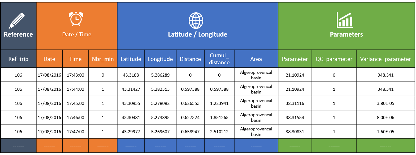
The metadata table is produced automatically at every refreshment process. In fact, The FerryBox team are developing a full application that reproduces, periodically, the same pre-treatments and quality control, for every received file. The database is, then, stocked in the web server that hosts the dynamic web application. Metadata table is stocking the following information: 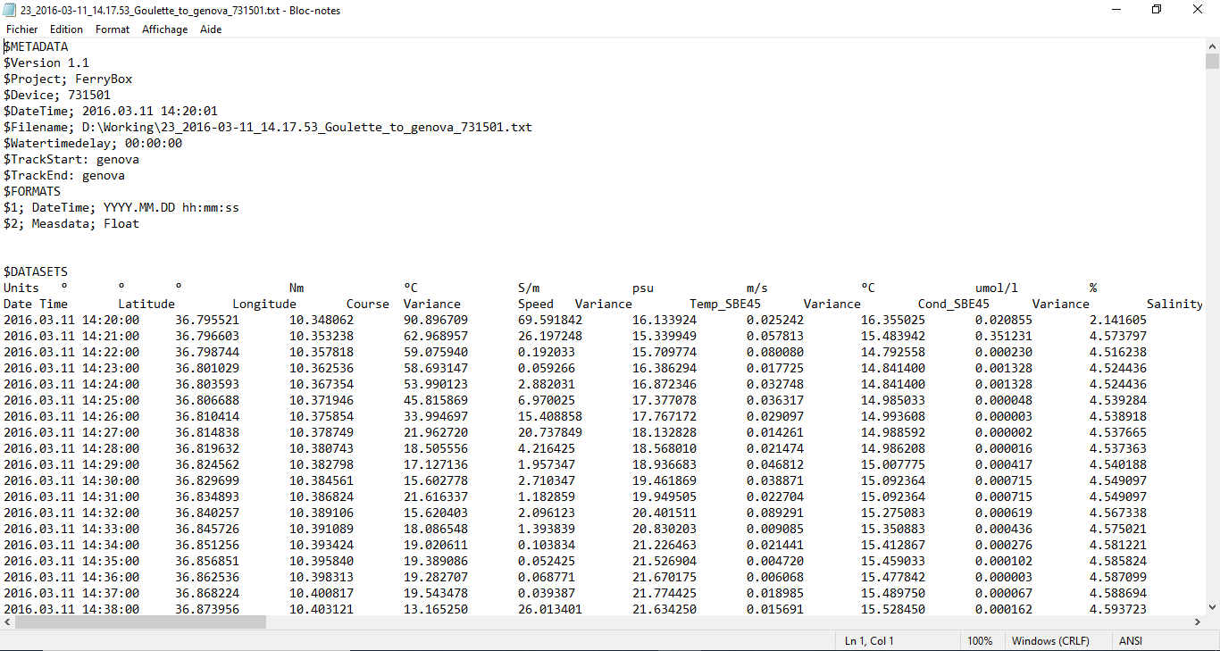
|
|
 |
|
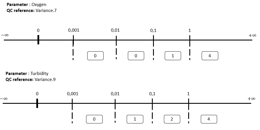
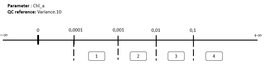
Data quality control has the following objective: 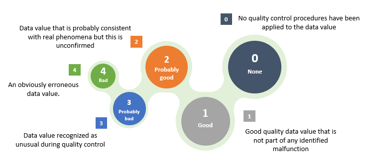
NB: SeaDataNet is a European Infrastructure (DG-Research – FP6) project which is developing and operating a Pan-European infrastructure for managing, indexing and providing access to ocean and marine environmental data sets and data products and for safeguarding the long term archival and stewardship of these data sets. Data are derived from many different sensors installed on research vessels, satellites and InSite platforms that are part of various ocean and marine observing systems. Data can be considered ‘trustworthy’ after thorough processing methods have been carried out. At this stage they can be incorporated into databases or distributed to users via national or international exchange. 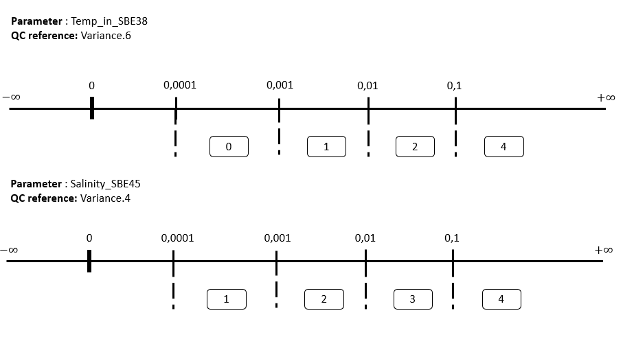
|
|